Space Application Division
WHO WE ARE
Space Applications Division has been engaged in the activities in the area of RS/GIS (Remote Sensing/Geographic Information Systems).
Arthur C Clarke Institute for Modern Technologies was designated as the National Focal Point for Space Technology Applications in the Island at the Ministerial Conference on Space Applications for Development in Asia and the Pacific, held in Beijing in 1994.

Having recognized the need for a national platform for dissemination and exchange of knowledge and experience in the areas of Geographical Information systems, Remote Sensing and Global Positioning Systems to address the socio economic issues pertaining to the management of spatially disbursed resources in the Island ACCIMT has organized several National Conferences.
In order to achieve the vision and mission; to develop, foster and facilitate the domestic base modern technological capabilities through innovation, research & development, training, industrial services and international collaboration, Space Technology & Applications Division at the Arthur C Clarke Institute for Modern Technologies is doing their best using Remote Sensing (satellite remote sensing and airborne remote sensing) and Geographic Information Systems (GIS) in a wide range of applications.
WHAT WE OFFER
The current projects which are being carried out at the Space Technologies & Applications Division are agricultural drought monitoring and early warning, GIS for niche modelling of Dengue Fever, national hub for receiving and distribution of earth observation data. Furthermore, feasibility studies are being carried out with regard to early detection of Blistor Blight disease of tea, land use land cover mapping for Sri Lanka, crop monitoring and revealing reasons behind agricultural diseases etc.
Our Team

Mr. Saraj Gunasekara Principal Research Scientist (Astronomy) Acting Director (Space Technology & Application)
B.Sc. in Physical Science,University of Colombo(2003)
Post Graduate Diploma in Remote Sensing and Geographic Information Systems,Indian Institute of Remote Sensing(2010)
Research Interests- Remote Sensing Applications, GIS applications, UAV and Network science.
Mr. A. R. Mohamed Rila -Research Scientist
B.Sc. in Physical Science,University of Colombo(2003)
Post Graduate Diploma in Remote Sensing and Geographic Information Systems,Indian Institute of Remote Sensing(2010)
Research Interests- Remote Sensing Applications, GIS applications, UAV and Network science.
Mr. Buddika Sampath Marasinghe-Research Scientist
B.Sc. in Agriculture,University of Peradeniya (2004)
M.Sc. in GIS and Remote sensing,Post Graduate Institute of Science,University of Peradeniya (2009)
Research Interests- Remote Sensing, GIS, UAV and field spectroscopy.
Ms. Nilushika Jayawardhana -Research Scientist
B.Sc. in Surveying Sciences,Sabaragamuwa University of Sri Lanka(2014)
Post Graduate Diploma in Remote Sensing and Geographic Information Systems,Indian Institute of Remote Sensing (2017)
Research Interests- Remote sensing Applications, Satellite Image Segmentation and Artificial Neural Networks.
Mr. V M I Chathuranga -Research Scientist
B.Sc. in Surveying Sciences,Sabaragamuwa University of Sri Lanka(2014)
Post Graduate Diploma in Remote Sensing and Geographic Information Systems,Indian Institute of Remote Sensing (2017)
Research Interests- Satellite based Augmentation Systems, SAR and Hyperspectral,Network Analysis and Web GIS,Space, Aerial, & Terrestrial 3D Modelling, Mobile Mapping, UAV, LiDAR, Surveying & Geodesy.
Mrs. Umeshika Fonseka -Research Scientist
B.Sc.in Surveying Sciences,Sabaragamuwa University of Sri Lanka(2015)
M.Sc in Earth System Science,Chinese University of Hong Kong(2017)
Research Interests- GIS, Cartography, Environmental Remote Sensing,Geo-statistical modelling
Mr. Kamal Shantha Perera – Lab Assistant
Research Facility
GIS and Remote Sensing Consultancies

ACCIMT’s value added GIS and Remote Sensing Consultancy Services
Our team uses the latest GIS technologies to capture, analyze and display spatial data from both terrestrial and aquatic environments. We use GIS as a staple tool for graphical representation of environmental mapping and infrastructural data. Based on your needs, we develop cost-effective solutions using open and/or commercial data image analysis, and time-series analysis techniques validated products and processing methodologies with scientific reporting.
Laboratory / Equipments / Soft wares
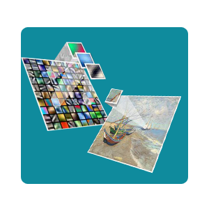
Image processing and analysis facility
We are involving in digital Image Processing which are applied to remote sensing images obtained from various satellite sensors including Image preprocessing, Enhancement, Transformation and Classification. The processed image can be used to interpret visually or electronically or digitally to extract the information about the illuminated target.
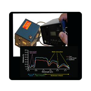
Spectroscopic facility with hand-held contact probe and PSR-1100F portable Spectroradiometer
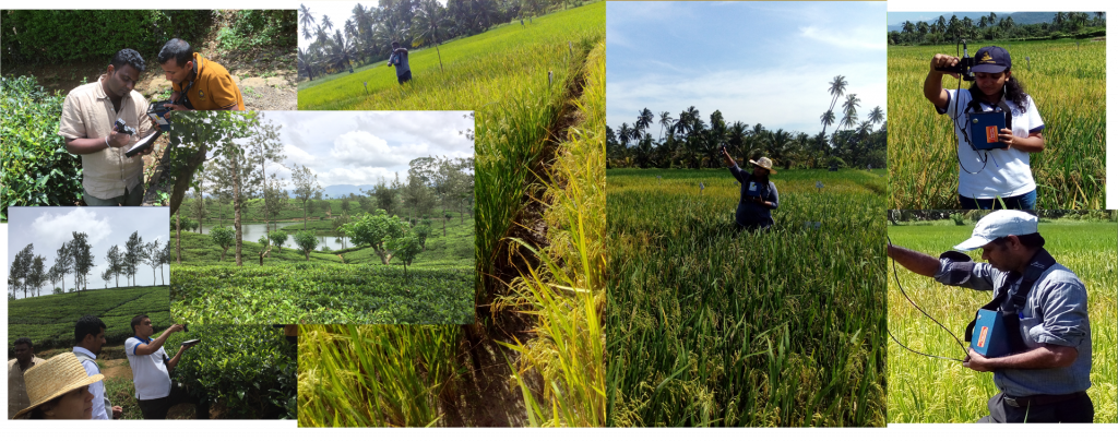
Arthur C Clarke institute have in hand spectroscopic facility with hand-held contact probe and PSR-1100F portable Spectroradiometer (spectral range of 320–1100 nm) which take measurements of spectral reflectance and spectral radiance of a source. This instrument has stand-alone systems that work independently without need to be connected to a PC. This makes highly portable while maintaining the accuracy of a spectroradiometer.
Universities and research organizations are welcome if they are interested with collaborative projects.
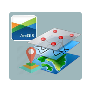
ARCGIS 10.5
ArcGIS is a geographic information system (GIS) working with maps and geographic information. It is used for creating and using maps, compiling geographic data, analyzing mapped information, sharing and discovering geographic information, using maps and geographic information in a range of applications, and managing geographic information in a database.
The system provides an infrastructure for making maps and geographic information available throughout an organization, across a community, and openly on the Web.
Continuous Professional Development Courses
Short course on Geo-information for earth system science
Introduce the use of geo-information technology, GIS, remote sensing, GNSS and Cartography, with the concepts of earth system science for the sustainable development of the country

Research methods & design for geographical information systems and remote sensing
Introduce an exploration of issues of general relevance to empirical investigation in the field and an overview of research methods.
RESEARCh AREAS
Agriculture and Forestry

Rice Yield Forecasting & Cultivated Paddy Area Identification
Effective pre-harvest crop yield estimation is important for an assessment of seasonal production for strategic planning purposes. A reliable forecasting methodology helps to properly manage some unexpected situations.

Detection and Assessment of Blister Blight disease in Tea Canopies
Blister Blight, caused by biotrophic fungus known as “Exobasidium vexans Massee”, affects the young tea leaves and leave diseases are very significant in tea production.

Investigate the Potential of use of Synthetic Aperture Radar (SAR) data for Forest Height Estimation of Sri Lanka
Forest Cover is a Critical ecosystem component. Therefore it is real requirement to robust, easy method to monitor Forest condition frequently to better Management activities.

Monitoring and Quantifying the Forest Degradation in Sri Lanka
Forest cover is a critical ecosystem component. Deforestation and forest degradation are the biggest threats to forests worldwide.
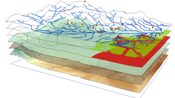
Environmental and Land Monitoring

Agricultural Drought Monitoring
Agriculture is the base of national Food Security. As an agriculture based country, the monitoring of agricultural droughts in cultivated areas of Sri Lanka is vital.

Influence of Land Use and Land Cover Change on the Lightning
Lightning is unpredictable disaster and it occurs as a result of high air temperature near the surface during summer days and started to begin as result of static charges in a rain cloud.
Marine and Coastal Monitoring

Space Technologies for Assessment on Environmental Factors and Marine Cultured Pearl production Areas in Sri Lanka
Cultured pearls are simply real pearls managed in a semi-controlled environment.
Health and Human services

Use of Geographic Information Systems for niche modeling of infectious diseases using remotely sensed environmental factors
Blister Blight, caused by biotrophic fungus known as “Exobasidium vexans Massee”, affects the young tea leaves and leave diseases are very significant in tea production.
Research Publications
Journal Publications
- Fonseka, H., Zhang, H.,Sun, Y.,Su, H.,Lin, H.,Lin, Y.(2019) Urbanization and Its Impacts on Land Surface Temperature in Colombo Metropolitan Area, Sri Lanka from 1988 to 2016. Remote Sens. , 11, 957.
- Shashi Kumar, Rahul Dev Garg, Satya P. S. Kushwaha, W. G. N. N. Jayawardhana and Shefali Agarwal, “Bistatic PolInSAR inversion modelling for plant height retrieval in a tropical forest” Proceedings of the National Academy of Sciences, India Section A: Physical Sciences, Volume 87, Issue 4, December 2017, Pages 817-826, ISSN 2250-1762; (Springer) http://dx.doi.org/10.1007/s40010-017-0451-9
- W.G.N.N Jayawardhana, V.M.I Chathurange(2016). Extraction of agricultural phenological parameters of Sri Lanka using MODIS, NDVI time series data. Procedia Food Science 6 ,pp 235 – 241.
- Gayantha R.L.Kodikara,P.K.Champati ray,Prakash Chauhan,R.S.Chatterjee(2016)."Spectral mapping of morphological features on the moon with MGM and SAM", International Journal of Applied Earth Observation and Geoinformation, Volume 44,PP 31-41
- I.P. Senanayake, W.D.D.P. Weliwitiya, P.M. Nadeeka(2013),"Remote sensing based analysis of Urban Heat Islands (UHIs) with vegetation cover in Colombo city, Sri Lanka using Landsat ETM+ data",Urban Climate, 5:19–35
- I.P. Senanayake(2013),"Anticipated prospects and civilian applications of Indian satellite navigation services in Sri Lanka",The Egyptian Journal of Remote Sensing and Space Science, 16:1,pp 1- 10
- Xue-Qing Yang,Gayantha R.L Kodikara,Eike Luedeling,Xue-Fei Yang,Jun He,Pei-gui Liu,Jian-Chu Xu(2012)"Looking below the ground:Prediction of Tuber indicum habitat using the weights of evidence method".Ecological Modelling 247,pp 27– 39
- Senanayake, I.P. et al.,(2012) 'Analysis of the abundance of abandoned tanks in Hambantota District, Sri Lanka using GIS techniques", Egypt. J. Remote Sensing Space Sci.
- I. P. Senanayake, Gayantha R. L. Kodikara, B. Y. A. Wijayanayake(2012),"Prospects of Using Geographic Information Technology in the Public Health Sector of Sri Lanka",Research & Reviews: A Medical Science and Technology,Vol 1:3
Conference Proceedings
- Fonseka HPU, Thunendran P, Wijesinghe L.V, Marasinghe BS, MohomedRila AR (2018) “Geographical Information Systems for prediction of dengue using remotely sensed environmental factors”. Fourth International Conference on Global Public Health 2018 - GPH2018,13 -14 June 2017, Negombo, Sri Lanka, ISBN:978-955-4543-43-0
- Wijesinghe L.V, Fonseka HPU, Marasinghe BS and Mohomed Rila A, (2018) “Use of Spectral Signature Characteristics to Differentiate Mangrove Species”.2nd International Research Symposium on “Emerging Technologies for an Innovative Green Economy”, Uva Wellassa University, Badulla,1-2 February 2018,2018
- T. Chandana Peiris (2017) “Challenges of Space Debris & site selection criteria to install an Optical Telescope to observe space debris in Sri Lanka”, The Open University Research Session – 2017, held on 16th & 17th November 2017. (Refereed Paper)
- Marasinghe BS, Fonseka HPU, Jayawardana WGNN, MohomedRila AR, RathnayakeWMUK, Sirisena DNand, Benthota AP (2016) “Evaluation of Spectral signature characteristics of traditional rice varieties of Sri Lanka”. Proceedings of the Wayamba University InternationalConferenc,Sri Lanka,19-20 August 2016,Theme 07,pp 303 Extraction of agricultural phenological parameters of Sri Lanka using MODIS, NDVI time series data (2015)
- G.R.L.Kodikara,I.P.Senanayake,W.D.D.P. Welivitiya,P.m.Nadeeka,A.R.M.Rila(2013)"Machine Learning Approach to Extract information using High Resolution Multispectral Data:a feasibility study".Proceedings of the Young Scietists Forum Sysposium,18th january 2013
- Lavanan Vengadasalam, Buddika Samapth Marasinghe, Chandima Subasinghe (2008). An Optimised Orbit Design and Determination for a Small Island for a Remote Sensing Nanosatellite Mission. Joint Conference of 30th ISTS, 34th IPEC and 6th NSAT symposium. Kobe-Hyogo, japan (2015-f-97p).
- N T S Wijesekera, T Chandana Peiris (2008) “The status of RS / GIS / GPS Applications in Sri Lanka – A Survey of Public, Private and Non-Governmental Organizations” The ENGINEER journal of the Institution of Engineers, Sri Lanka Vol: XXXXI, NO: 05. (Refereed Paper)


