Our team uses the latest Geo Spatial technologies to capture, analyze and display spatial data from both terrestrial and aquatic environments. We use GIS as a staple tool for graphical representation of environmental mapping and infrastructural data. Based on your needs, we develop cost-effective solutions using open and/or commercial data image analysis, and time-series analysis techniques validated products and processing methodologies with scientific reporting.
ACCIMT’s value added GIS Consultancy Services include
• Digital mapping and cartographic services
• Data Digitization and Management
• Geodata processing (analysis, conversion and …....visualization)
• Custom Cartography and database design
• Vectoring and digitizing of raster-data, …... automated raster-vector conversion
• Topographic Mapping
ACCIMT’s value added
remote sensing products/services include
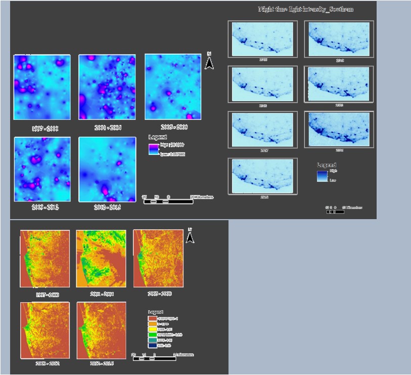
• Satellite imagery interpretation and classification
• Change detection
• Slope aspect analysis
• Land cover classification
• Network Modeling
• Topological modeling
• Terrain Modelling including Digital Elevation Models, Digital Terrain Model etc.
Training
Customized Continuous Professional Development (CPD) training programmes ranging from fundamental to advanced subject matter can be arranged catering for specific user requirements